TheWorker
-
Aantal bijdragen
81 -
Geregistreerd
-
Laatst bezocht
-
Gewonnen dagen
1
Soort bijdrage
Profielen
Forums
Kalender
Alles door TheWorker geplaatst
-
Precies dat is het, je moet eerst "ga" aantikken (dus een route er naartoe (simuleren)) en dan kun je pas de hint zien en hem ook loggen. Bij de Monterra kon ik de cache gewoon aantikken en dan ook gelijk loggen of de hint zien. Dat "ga" tikken en dan de route er naartoe berekenen had van mij niet gehoeven omdat ik niet altijd een route plan naar een cache. Ik vind het nu niet dramatisch hoor, maar een beetje jammer
-
Heb de Montana voornamelijk op de motor en nog niet in de regen gereden :D. Je hebt 3 instel mogelijkheden bij de Montana m.b.t gevoeligheid van het touchscreen. - regen - normaal - handschoen Zodra ik het één en ander heb kunnen testen dan zal ik het hier plaatsen.
-
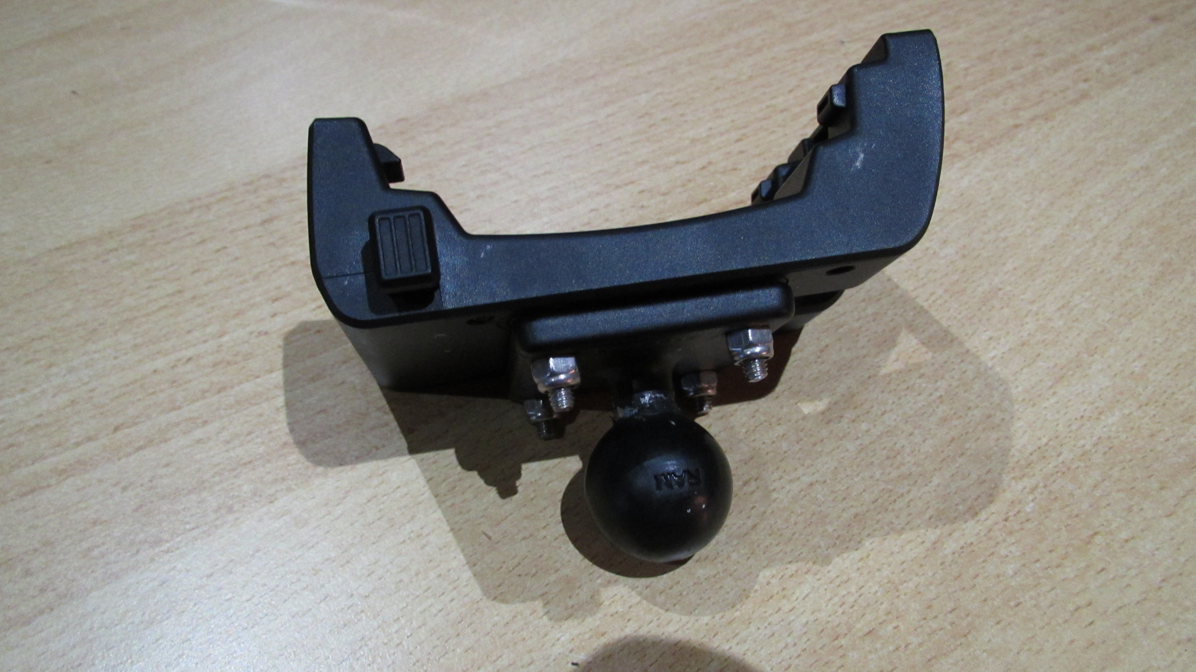
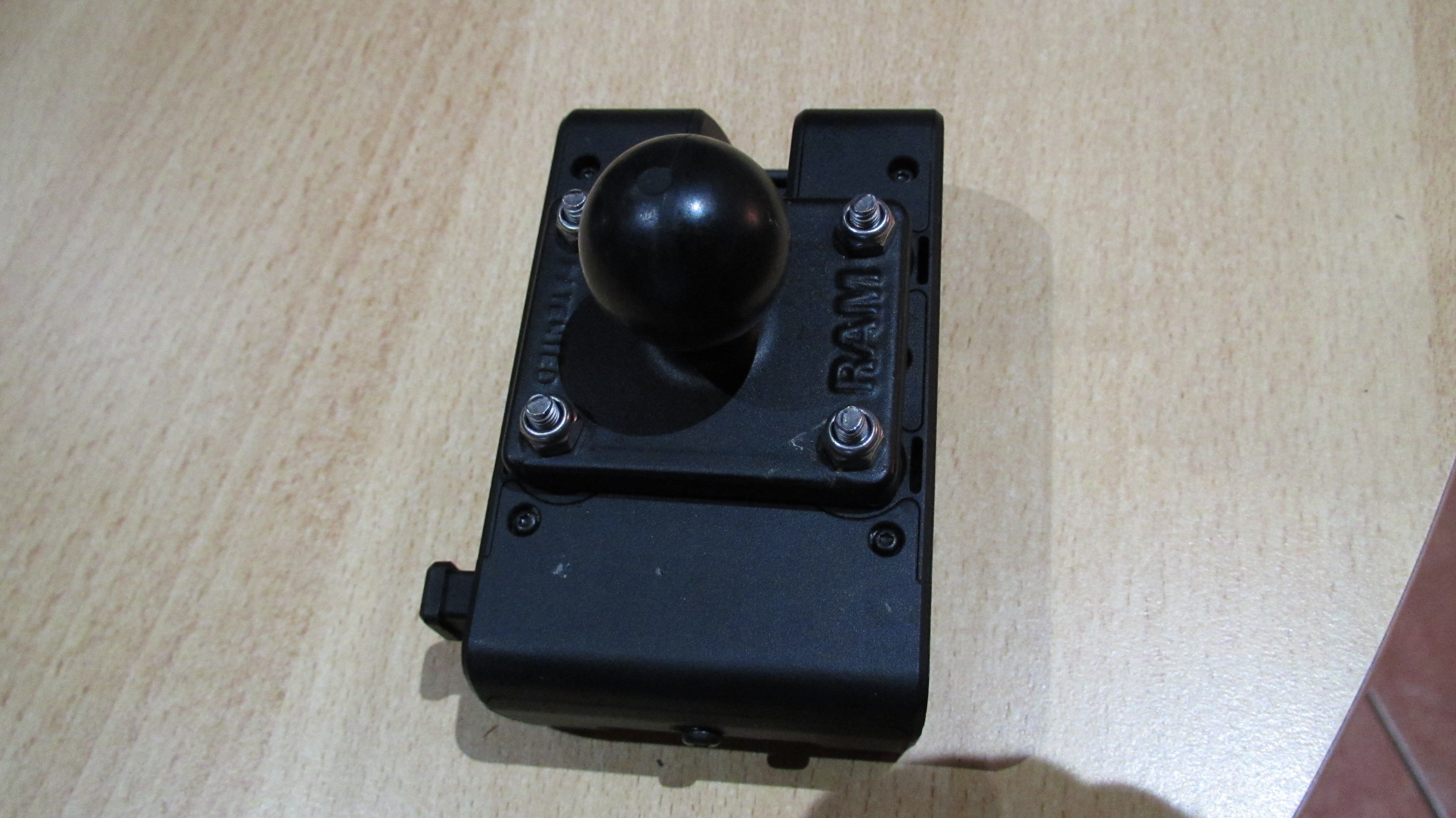
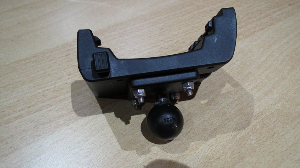
Klopt, je moet er nog een adapter bij halen. Volgens mij is het een RAM-B-347U, die past op de Cradle en ook op de lange dubbele Socket Arm.

-
Ja die is er. Heb er zo 1 voor op de motor. Je kunt die met stroomkabel krijgen (voor de motor dus) en gewoon de houder voor op de fiets. Dit kun je dan dmv Ram Mount op de fiets monteren. https://buy.garmin.com/nl-NL/NL/p/pn/010-12881-01
-
Inderdaad. Volgens betrouwbare bronnen is het ook alleen maar bij de Monterra mogelijk om zonder een route te activeren de cache volledig te bekijken. Prima toestel hoor die Montana 700, ben er heel blij mee, maar dat vind ik wel een klein minpuntje.
-
Ben er inmiddels achter dat het niet mogelijk is. Je MOET naar een cache navigeren om meer details van de cache te kunnen zien.
-
Ben overgestapt van de inmiddels verouderde Monterra naar de nieuwe Montana 700. Opzich prima toestel, mooi scherm en redelijk wat sneller als de Monterra. Wat ik nogal lastig vind dat ik eerst naar een cache moet navigeren om hem te kunnen loggen, activiteiten of een hint te kunnen zien. Eigenlijk wil ik dus zonder een route te plannen naar een cache lopen en gewoon de hint of de activiteiten zien. Met de monterra was dit gewoon mogelijk. Is hier een andere manier voor of is het gewoon niet mogelijk met de 700?
-
Natuurlijk werkt de software van Garmin super op de Monterra en vind het ook nog steeds een super toestel. Android gebruik ik op de Monterra voor geocaching apps, bijvoorbeeld voor codes, notities, barcodescanner enz. Heb de Monterra toen gekocht omdat ik in het begin onderweg was met een navigatie, papier, tablet en bijna geen tijd had om de cache te zoeken. De rest van het team vroeg zich soms wel eens af of ik aan het cachen was of dat ik de boekhouding deed Nee hoor, het is nog gewoon een super toestel, maar omdat ik de melding van Cgeo kreeg dat het updaten niet meer lukte, vroeg ik met toch af het mogelijk zou zijn om de Android versie te updaten.
-
Happy new year Vind het jammer van Garmin dat ze zo´n eigenlijk super toestel op de markt brengen en dat ze hem dan na een paar updates afschrijven. Leuke zin "Garmin zal u van harte verwelkomen in hun shop"... De Monterra was niet echt goedkoop toen! Dacht dat het misschien mogelijk was om zelf m.b.v. een omweggetje een andere versie van Android erop te zetten. Het zal niet lang meer duren dan draait alleen Garmin´s eigen navigatie nog op het toestel en dan kun je net zo goed overstappen naar een Oregon. Vond dat Android (in verbinding met een wlan-hotspot) onderweg altijd wel handig . Naja we wachten het af, maar hem niet veel hoop eerlijk gezegd...
-
Weet iemand of het mogelijk is om de Android versie een update te geven op de Monterra? Cgeo geeft ook al problemen nu.
-
Ik zal er eens mee gaan spelen Twentse Mug, dank je
-
Gevonden, je moet dan wel donateur zijn zie ik. Bedankt brouwertjes
-
Vraagje, is het mogelijk om alle logs van een bepaalde cacher te vinden? Nu bedoel ik natuurlijk niet om alle gevonden caches te bekijken, maar een zoekopdracht zodat je alle logs onder elkaar krijgt. Heb het met google geprobeerd, maar zonder succes. Kent iemand hier een mogelijkheid?
-
Probleem eindelijk opgelost. Het bestandje "UserData.sqlite3" tijdelijk verplaatst van de "\Garmin\SQL" naar de "\Garmin\POI" map en toen de Monterra opnieuw opgestart. Er werd netjes een nieuwe "UserData.sqlite3" bestand aangemaakt en het probleem is opgelost.
-
Heb laatst via GSAK een paar caches (6 stuks) naar de Monterra geinstalleerd en ze blijven zichtbaar, zelfs na het verwijderen van alle .gpx bestanden. Heb het bestand (met "Bestand - Exporteren - GPX/LOC bestand") gewoon test.gpx genoemd en toen via explorer naar de Monterra gekopieerd (in de map GPX). Nu wilde ik alle caches van de Monterra verwijderen om nieuwe .gpx bestanden toe te voegen,maar de caches uit het bestand "test.gpx" zijn nog steeds onder "Geocaching" te zien. Iemand een idee hoe ik die eruit krijg?
-
De rare tekens zijn inmiddels weg, hoop dat het zo blijft. Howto: Een hele tijd koppelde ik de Monterra aan de pc via USB en haalde ik gewoon de gpx-bestanden via de pc naar de Monterra. Dit gaf ineens problemen, zie boven. Nu heb ik eerst alle gpx-bestanden van de Monterra gehaald, dan de Monterra van de pc losgekoppeld en gewacht tot hij alles heeft geladen. Nu laat hij onder "Geocaching" dus niets zien. Weer terug naar het hoofdmenu en de Monterra weer met de pc verbonden. Alle nieuwe gpx-bestanden (in mijn geval: multi.gpx, caches.gpx, opgelost.gpx en bonus.gpx) waar naar de Monterra gekopieert en de Garmin weer losgekoppeld. Na inladen van de gpx-bestanden is alles weer ok, dus zie weer de hints, beschrijving en ook de normale text bij de waypoints. Het is alsof er iets bleef hangen van de gpx-bestanden in de Monterra waardoor hij gek ging doen. Nu afwachten of het ook zo blijft
-
Aanvulling. Als ik het GPX-bestandje open in MapSource, dan staat er wel gewoon de tekst bij. Het GPX-bestandje aangemaakt dmv GSAK is dus ok. Ik sleep het GPX-bestand gewoon dmv explorer naar de map GPX, dus aan de overdracht kan het eigenlijk ook niet liggen. De Monterra kan 4000 waypoints aan en het GPX-bestand die ik heb aangemaakt bevat iets meer als 2000,dus daar kan het ook niet aan liggen...
-
Heb nogal problemen met rare tekens (lijkt op chinees) op mijn Monterra. Ze komen voor bij waypoints onder het kopje "OPMERKING". Heb geen flauw idee waar ze vandaan komen, maar het is knap lastig. Vooral als je spontaan een multi wilt lopen en je de beschrijving niet kunt lezen. Ik importeer de boel nog steeds met actuele GSAK en GarminExport macro. Het komt soms ook voor dat er geen beschrijving bij de Multi-cache staat en dan mist ook de hint. Kent iemand dit probleem en misschien ook de oplossing?
-
Mooi dat het is gelukt en bedankt dat je nog ff vermelde wat het probleem was
-
Heb zelf ook nog een Oregon600 en die laat ook gewoon de GC-codes zien in het geocache_visit.txt bestandje. Volgens mij kun je dat in de Oregon niet instellen,dus het moet haast aan het programma liggen waarmee je de caches op de Oregon plaatst.
-
Denk niet dat dat lukt met de Montana. Heb net ff gekeken op de Monterra en die optie heeft hij niet.
-
Probeer ook eens er een uSD-kaartje in te doen en dan de Nuvi weer op de pc aansluiten. Heb een dergelijk probleem al eens gehad en toen zag hij het intern geheugen (en het kaartje) alleen als er een uSD-kaartje in zat.
-
Bedankt voor het antwoord! In het begin ging ik naar navigeren-waypoints en kreeg inderdaad de waypoints bovenaan te zien die het dichtste bij waren. Inmiddels doe ik het gewoon via de kaart en kies inderdaad zelf de route er naartoe. De final location moet inderdaad wel via waypoints omdat die buiten de kaart ligt. Vind het jammer dat als ik een multi kies, dat daar dan wel alle waypoints bij staan,maar je niet de volledige tekst direct kunt oproepen, zou een stuk gemakkelijker zijn.
-
Hoe regelen jullie dat met multi´s waar waypoint bij zitten met vragen? Als ik naar een multi ga en ik druk op "ga", dan zie ik wel de waypoints die ik kan kiezen, maar de tekst/vraag staat er maar half. Als ik de waypoint via de kaart kies dan is de tekst wel leesbaar, maar als ik dan op "terug" druk, dan krijg ik vaak de foutmelding dat de outdoor.app is gestopt. Als ik dan op wachten druk, dan gaat hij vaak wel terug. Het is net alsof de foutmelding sneller is dan dat de Monterra de "terug-fase" kan verwerken. Wat ik wil is gewoon snel naar het volgende punt navigeren en dan ook de tekst/vraag zien wat er bij het waypoint staat.
-
Klinkt voor mij alsof er een foutieve gpx-bestand op staat. Het komt bij de Nuvi´s ook wel eens voor en dan start de Garmin ook niet. (kan ook nog aan de kaarten liggen) Ik neem aan dat je wel op het intern geheugen kunt komen, dus maak even een backup van de gpx-bestanden, verwijder ze van de Monterra en start hem opnieuw op. Dit probleem heb ik zelf nog niet gehad bij de Monterra (al heb ik de foutmelding wel eens gezien), maar het is het proberen waard.